
Walk Painesville Township Street Records
The first Painesville Township street-level result should be a parcel record, not a claim about a household. Start with the street in the Auditor’s property roll, choose a parcel, and write down the PIN, situs address, owner field, current deed reference, and legal description. Then use LakeNavigator to see the parcel on the map and open any supporting record links. The Recorder trail comes after that, because older deeds can be filed by legal description or document reference rather than a modern street label.
The sequence narrows a street result without losing the distinction between land records and resident evidence. A directory volume may support a past address association. The voter tool can verify a known individual using its name-and-county form. Neither produces a public browse of everyone along the street. The search is strongest when each result remains labeled by source and date.
- Search the Auditor using the street fields, omitting the suffix first and using the documented wildcard when a street-wide parcel result is needed.
- Open a result and capture the parcel PIN, situs address, deed reference, owner field, mailing field, and legal description separately.
- Search the PIN, owner, or address in LakeNavigator, select the Parcels result, and click the parcel for its map attributes and links.
- Use the deed number, volume and page, or legal description in Recorder AVA to follow the current grantee to an earlier grantor.
- For a dated address question, check the appropriate Morley street section or Haines criss-cross edition, then compare it with other dated records.
Note: A Painesville Township address search begins with land records because a street label alone can change or appear inconsistently in older documents.
Search Painesville Township Street Parcels
The Lake County Auditor Basic Property Search is the verified Painesville Township portal built for the first parcel-search pass. It accepts a parcel ID, owner text, split address fields, and a Postal Code. No individual field is marked required. The street field is limited to 17 characters, and the County advises leaving off a street suffix for best results. Its own example, *Arden, returns all addresses on Arden when the wildcard precedes the street term.
| Search field | Type | Required | Street-directory use |
|---|---|---|---|
| Parcel ID | Text, up to 20 characters | No | Enter a full PIN; * returns a group beginning with the supplied prefix. |
| Owner | Text | No | Use full or partial name with wildcard options for a known recorded owner. |
| Address number and direction | Text and dropdown | No | Use a known number or direction to narrow a long street. |
| Street and suffix | Text and dropdown | No | Search the street without suffix first; use the documented wildcard approach where useful. |
| Postal Code, sort, results | Text and dropdowns | No | Narrow by postal code and sort by parcel, owner, parcel address, or unit/building. |
The Auditor advanced property-search screen illustrates the County’s additional criteria builder and result controls.
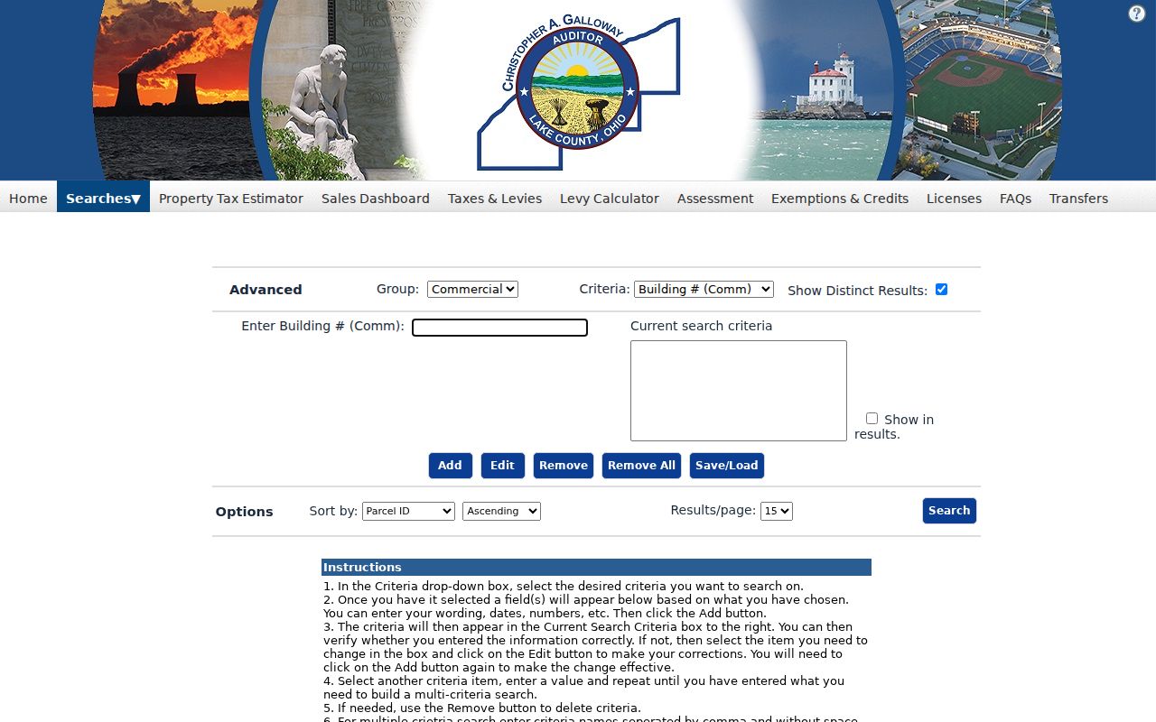
Start broad enough to find the parcel, then rely on the PIN and legal description rather than repeatedly widening a street-name query.
Read Painesville Township Parcel Labels
Parcel data has several address families, and they must not be collapsed into “resident.” The GIS and Auditor schema separate the situs or location address from the deeded owner and from owner or taxpayer mailing fields. A mailing address can be outside Painesville Township because it is used for tax correspondence. The parcel’s legal description identifies the land in the deed and plat system. It is often the durable bridge when a street abbreviation, number, or old subdivision label does not line up.
The public Painesville Township parcel schema also lists the PIN, map or property number, acreage, deed volume and page or deed number, sale date and amount, land-use classification, assessment values, location ZIP, and Tax Map, survey, plat, and site-plan links. Those categories explain what a street-based record can document about a property without presenting an owner name as an assertion of current residence.
| Parcel record field | What the field identifies |
|---|---|
| PIN or parcel number | The County parcel key used to carry a property search across records. |
| Location or situs address | The physical Painesville Township property address shown on the roll or map. |
| Deeded owner and owner address | The ownership field and separately stored owner-address components. |
| Taxpayer name and address | The tax correspondence record, which can differ from the property location. |
| Legal description and deed reference | Land-description and recording clues used to find a deed or plat. |
| Tax Map, Survey, Plat, and Site Plan links | County routing fields where supporting materials are available. |
- Parcel or PIN
- The unique County identifier for the mapped property.
- Situs address
- The physical property location displayed in the parcel roll.
- Plat
- A recorded map that lays out lots, streets, and subdivisions.
- Criss-cross directory
- A reverse directory arranged from address to a listed name for a particular edition year.
The official County parcel-layer metadata shows the separate owner, taxpayer, location, legal, and deed field families.
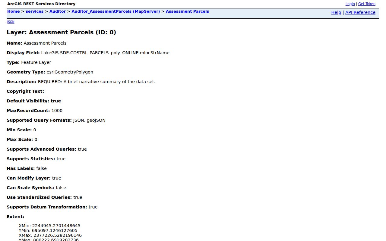
The field inventory supports careful labeling, especially when a postal mailing address and a Painesville Township property location do not match.
Map a Painesville Township Street
LakeNavigator is the map-view route for a Painesville Township address search. The County help says its upper-left universal search accepts a parcel or PIN with or without dashes, an owner name, or an address. As text is entered, it offers choices, and the County advises that less information can produce more choices. A result may be grouped as a Parcel or as an Esri World Geocoder result, so choose the parcel result when the goal is County land data.
After locating a Painesville Township parcel, click it on the map to view the popup and any available attributes. The County confirms linked attributes for Auditor, Tax Map, Survey, Plat, and Site Plan records where they are populated. Address points and road centerlines are downloadable GIS data, while the map itself has more than 30 layers that can change over time. For a whole named street, begin with Auditor wildcard results and use the map to check the geography rather than treating the viewer as a bulk directory.
The LakeNavigator help page documents the search and parcel-click path used for this street-by-street check.
A map click confirms a parcel’s placement on a street, but the supporting recorded and dated materials remain necessary for history or identity questions.
Painesville Township Address Record Coverage
Address-keyed sources form a Painesville Township address-record chain. Each layer answers a narrower question than “who lives here.” The coverage table puts the parcel, map, land-record, Township, library, and voter routes in their proper roles. It also shows the fallback channel when a web screen does not contain the needed record.
| Address-keyed source | What it shows | Use and access | Limit or fallback |
|---|---|---|---|
| Auditor property roll | Current parcel, owner field, situs, Postal Code, assessment data | Number, street, owner, or PIN search; wildcard street query | Owner or mailing data is not resident proof; use Auditor counter for help. |
| LakeNavigator | Parcel geometry, PIN, legal description, record links | Universal search or map click | Viewer is dynamic; GIS office and official layer answer data issues. |
| Recorder AVA and books | Document parties, type, date, and reference | Deed reference, legal description, parties, book or page | AVA index starts 1986; Records Room reaches back to 1840. |
| Tax Map, surveys, plats | Lot, subdivision, parent parcel, and map context | PIN and parent-parcel research | Land mapping, not household membership. |
| Township zoning file | Address-linked certificate and application roles | Specific address and date request | No public online permit index was found. |
| Morley directories | Dated listed address connection | Exact edition and criss-cross check | Gaps and changing geographic coverage matter. |
| Ohio voter tool | Known individual’s registration result | First name, last name, and Lake County | No public street browse is promised; protected records are excluded. |
For a particular person rather than a street sequence, use the different name-first workflow on the Painesville Township resident lookup page after preserving the parcel facts.
Trace Painesville Township Street Deeds
Recorder AVA is the public index for the recorded land portion of a Painesville Township address trail. It offers search routes for name, document number and type, book and page, reference number, and address or legal information. A result can show document number, type, recorded date, party one, party two, legal-description data, and book or page where populated. It is better to carry the current deed reference from the parcel record than to assume a house address will retrieve every historic instrument.
Follow the chain backward by reading the current grantee or owner against the earlier grantor or seller, then locating that seller’s earlier acquisition. Verify the PIN, lot, subdivision, or legal description at each step. AVA’s electronic index begins in 1986. Available digital images begin in 1987. The Recorder has record books from 1840, public computer stations, a Records Room, Laredo Select after registration, and an email image process. Email requests from February 1, 1991 forward require a document or instrument number or volume and page, plus contact details.
The Lake County Recorder AVA index is the online search point. The Records Room, mail request with check and return envelope, or email request provide the documented alternatives when the web index or image does not resolve the need.
Note: The 2023 Land Record Center placed 5,000 books, including the 1840 archives, in Recorder Records Room B for pre-digital deed research.
Painesville Township Plat and Parent Parcels
Tax Map material helps when Painesville Township address research reaches a lot split, subdivision, or changed address label. Lake County keeps Painesville Township surveys by parcel number, and a split survey can be filed under the parent parcel number. Write down both the current PIN and any parent or out-parcel number before assuming that a missing survey or plat is absent. That extra identifier is often needed to connect the street location to the older land configuration.
The Tax Map Department also links historical resources, including 1857, 1874, 1898, and 1915 atlases, cemetery maps, historical split surveys, railroad valuation maps, road records, and site plans. Use the Tax Map counter when a needed survey or map is not linked online. These sources describe land and its mapping history. They do not list everyone who lived at a location, so use a dated directory or other independent record for a person association.
The Lake County Tax Map resources identify the parcel-based channel for plats, surveys, and historic map work.
Painesville Township Zoning Address Evidence
Township zoning records can date a stated use or property change, but they are not a Painesville Township household roster. The zoning-use-compliance application separates land owner, occupant, and agent fields at an address. It also requests a permanent parcel number, location, zoning district, unit identifier, and application information. The form itself shows why one named role must not be converted into a claim about everyone at the address.
No public online Township permit-record index was located. Send a targeted public-records request to the Township Administrator for available permits, zoning certificates, inspections, complaint dispositions, or resolution records at a specific address and date range. Requests may be made in person, by telephone, mail, fax, or email. Inspection is free, and the Township policy states the copy rules. The Township’s zoning map was updated in May 2024, and its published zoning process provides the local address-history layer after the earlier directory period.
The Township zoning page identifies the application, map, and contact route, while the records request supplies the fallback for a non-indexed file.
Painesville Township Street Directory History
Morley Library supplies the historic address layer for a Painesville Township street directory. Its catalog calls the 1923 Painesville directory the first identified local volume with a by-street listing. That date is useful for an address question, but the early title is not proof that every Township address was covered. The Township is explicitly named in holdings from 1940 onward under changing Painesville, Painesville-Mentor, and broader titles.
Haines and Company Lake-Geauga criss-cross volumes are the reverse address-to-name resource for 1976, 1977, 1981 through 1987, 1989, and 1991 onward when a listed edition exists. Gaps must be checked by volume. Morley’s room is appointment-only, with research contact by email, phone, or mail. A printed address entry is dated evidence. The full collection years, edition labels, and appointment process belong on the Painesville Township historical directory page, while a street search should use the edition as one part of a larger parcel trail.
The Morley city-directory holdings page is the source for the listed Painesville and Township-inclusive runs.
Painesville Township Voter Search Limits
Ohio My Voter Information is an individual verification form, not a Painesville Township street directory download. Its first screen requires first name, last name, and county. Lake County is the correct county selection for the Township. Following an initial result, it can prompt a street-name choice to narrow a known person. The official tips also suggest checking a first-name variation or former last name where appropriate.
Public voter information still has statutory redactions. The public form does not ask for a full birth date, Social Security number, state identification number, or an address on its first screen. It does not promise a complete street list or ballot choices. When a known record is not found, use the Board of Elections counter or its record-request process rather than treating an address search as a voter roster.
The Ohio My Voter Information form documents the required name-and-county fields and the conditional street-name refinement.
Painesville Township Address Authority Update
Lake County GIS is the government address authority for standardized, geocoded, mapped Painesville Township physical addresses. Its Addressing Hub supports municipalities, emergency services, mapping applications, and address-assignment work. The County’s downloadable address points and road centerlines have a stated January 16, 2024 date. In 2026, GIS also listed Building Footprints dated February 23 and promoted Lake Nav 4.0 Beta. These developments improve the street and map layer but do not change the need to verify a record with the correct custodian.
The County Addressing and Public Safety page explains the role behind the address points and public-safety mapping.
Use the authority’s address information to locate the property, then use parcel and deed records to understand its legal and historical context.
For postal confirmation, the USPS ZIP Code Lookup accepts a street address with city and state or ZIP, but its result does not verify a person at the address.
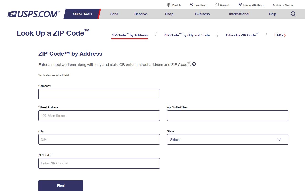
The postal city and ZIP should be treated as delivery information, not as a substitute for a Township jurisdiction or parcel determination.
Painesville Township Street Directory Limits
A Painesville Township street directory can document mapped parcels, recorded parties, owner and mailing fields, historic printed entries, and carefully requested local files. It cannot show a full current household roster. Property rolls usually do not list every person at an address. A zoning application’s occupant field is an application role. Motor-vehicle, utility, delivery, protected voter, and confidential-address data are not general public street sources.
Ohio’s address-confidentiality and voter protections remain in force even when a parcel or historic directory is public. A missing or redacted result is a legal boundary to respect, not an invitation to search around it.